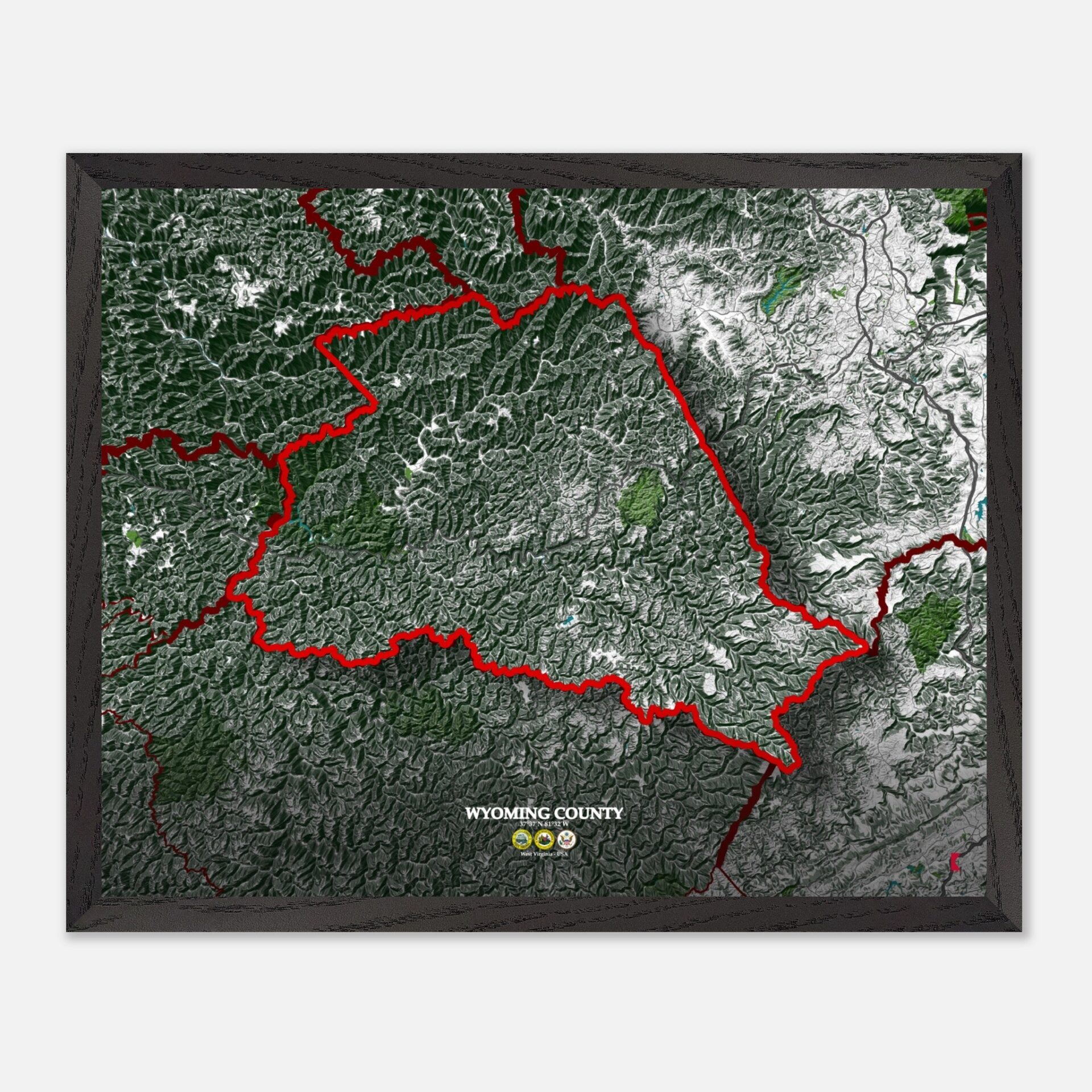
Wyoming County Map: A Map of West Virginia’s Heritage, Nature, and Connectivity
Wyoming County, located in the heart of West Virginia, is a region rich in history, natural beauty, and economic potential. Located in the southern part of the state, it shares borders with Raleigh County to the northeast, McDowell County to the south, and Boone County to the northwest.
Wyoming County forms part of a larger tapestry of West Virginia’s scenic counties, and this makes it a focal point for those looking to explore the Appalachian region’s cultural and natural landscape.
Historically, Wyoming County is home to sites that reflect the heritage of coal mining and the industrial revolution. The Mullens Historic District, listed on the National Register of Historic Places, stands as a testament to the county’s thriving past during the coal boom.
Other historical landmarks include the Oceana Historic District, which showcases the architectural beauty and community-centered developments of earlier times. These historical sites provide a glimpse into the county’s rich past.
Wyoming County’s economy has long been dominated by the coal industry, with its history closely tied to natural resource extraction. Today, coal remains a significant part of the local economy, but the county is also shifting towards other sectors such as healthcare and education.
Key economic hubs like Pineville and Oceana offer a blend of traditional industries and emerging services, making the county an interesting mix of old and new economic drivers.
With a population of around 20,000 residents spread over an area of 502 square miles, Wyoming County presents a small but tight-knit community. The county offers a serene environment for its residents, many of whom are rooted in family traditions passed down through generations.
This low population density contributes to a peaceful rural atmosphere, ideal for those seeking refuge from bustling city life.
The county’s diverse landscape, paired with its historical and economic significance, makes Wyoming County a unique destination. Its position within West Virginia, surrounded by other key counties, offers easy access to a mix of natural reserves, historical landmarks, and modern amenities. This blend of past and present makes Wyoming County a fascinating place to explore.
Wyoming County: A blend of past and present
It´s Easy Access To The County’s Scenic Landscapes

Wyoming County is well-connected through a network of highways and local roads, making transportation and travel convenient. U.S. Route 52 and West Virginia Route 10 are two major highways that traverse the county, linking it to nearby counties like Raleigh and McDowell.
Route 85 serves as another critical connector between local towns such as Oceana and Kopperston. These roads not only support local commerce but also allow easy access to the county’s scenic landscapes.
It´s Appalachian Mountains

The topography of Wyoming County is dominated by the Appalachian Mountains, giving rise to a series of rugged hills and valleys. Pinnacle Creek cuts through the county, carving deep valleys and offering stunning vistas.
The county’s highest points reach elevations around 3,000 feet, creating a varied landscape that is perfect for hiking and outdoor activities. Its rich landforms, shaped by centuries of geological activity, offer dramatic views and create natural divisions between its small towns.
It´s Green Areas

Wyoming County is dotted with several green spaces that showcase its natural beauty. R.D. Bailey Lake is the centerpiece of R.D. Bailey Lake State Park, offering recreational activities such as boating, fishing, and hiking.
The park also supports a diverse range of flora and fauna, including native hardwood forests and wildlife like deer, foxes, and various bird species. With a temperate climate, the county experiences mild summers and cool winters, making it an inviting destination year-round.
Water Features

The Guyandotte River flows through Wyoming County, providing a vital water source for the region’s towns. This river is essential for both recreational activities and the local ecosystem, supporting fishing and wildlife habitats.
R.D. Bailey Lake, a key water body, serves as a reservoir that helps regulate flooding in the region and provides scenic views for visitors. These water features play a crucial role in the county’s identity, tying together its communities and offering opportunities for tourism and leisure.
Wyoming County Map – WV: A Detailed Snapshot
| Municipality/Town/City | Population | Area (sq mi) |
| Pineville | 600 | 0.75 |
| Oceana | 1,394 | 1.5 |
| Mullens | 1,559 | 1.0 |
| Kopperston | 616 | 0.9 |
| Brenton | 250 | 1.2 |
| Wyoming County | 20,000 | 502 |
A map of Wyoming County is not just a practical tool for navigating the area, but it can also serve as a unique piece of decor. With its rugged mountains, flowing rivers, and historical towns, the map offers a vivid representation of the county’s character.
Whether hung in a home office, living room, or study, a Wyoming County map brings a slice of West Virginia’s natural beauty and history into any space. It’s a visual reminder of the county’s past, present, and the breathtaking landscapes that continue to shape it today.


