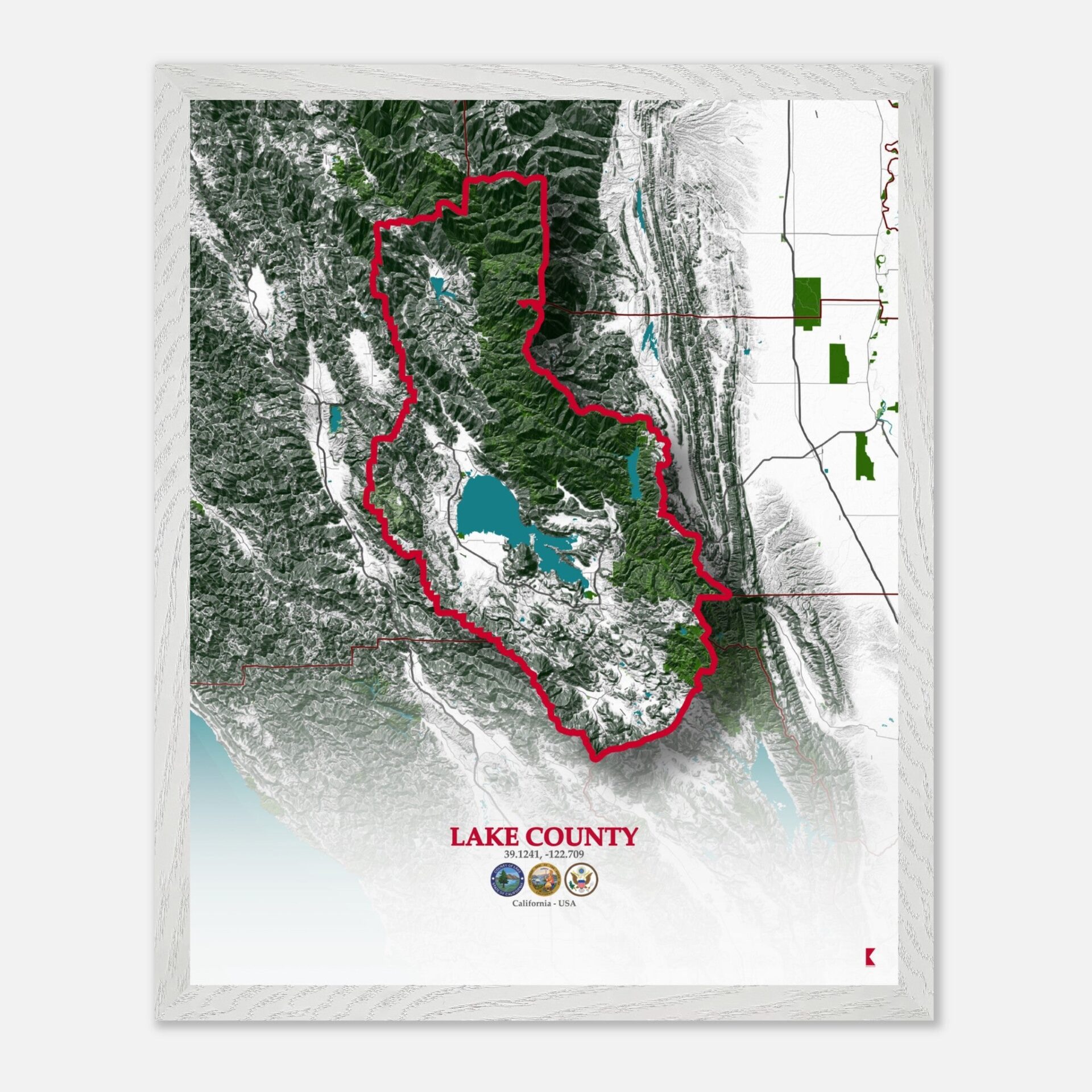
Lake County Map: A Guide to California’s Hidden Gem
Lake County offers a scenic retreat with its diverse landscapes and rich history. Situated between Mendocino County to the west and Yolo County to the south, Lake County is a part of the vibrant state of California, and is known for its picturesque views and unique geographical features.
The county’s location provides easy access to neighboring counties and underscores its role as a central hub within the region.
Lake County boasts a fascinating array of historical sites that draw visitors from near and far. Among these is the historic city of Middletown, which played a significant role during the California Gold Rush era.
Additionally, the county is home to the Anderson Marsh State Historic Park, preserving remnants of early California history and offering insights into the region’s past.
Economically, Lake County has traditionally relied on agriculture, with vineyards and fruit orchards forming the backbone of its economy. The county also has a burgeoning tourism sector, with attractions like Clear Lake drawing visitors year-round.
This blend of agriculture and tourism supports a diverse local economy and contributes to the county’s unique charm.
Covering an area of approximately 1,329 square miles, Lake County is home to a population of around 64,000 residents. The county’s demographic and spatial characteristics make it a dynamic region with a range of community services and natural amenities.
In this article, we’ll delve into the specifics of the Lake County map, highlighting its roadmap, topography, and natural features. Whether you’re a local resident or a visitor, understanding these elements will enhance your appreciation of Lake County’s unique geography and history.
Diving into the specifics of the Lake County map
The Network Of Key Highways And Roads

Lake County is connected by a network of key highways and roads that facilitate travel throughout the region. The primary route is Highway 20, which runs east-west across the county, linking the cities of Clearlake and Lakeport.
Highway 29, running north-south, serves as a major corridor connecting the county to Napa and Vallejo. Additionally, Highway 53 provides a critical link between the southern part of the county and the city of Lower Lake. These highways form the backbone of Lake County’s transportation infrastructure, making travel within the county and to neighboring areas efficient and accessible.
It´s Diverse Landforms, Including Mountains, Valleys, And Lakes

The topography of Lake County is characterized by its diverse landforms, including mountains, valleys, and lakes. The county is dominated by the Clear Lake basin, which is the largest natural lake in California. Surrounding this lake are the rugged peaks of the Mayacamas Mountains to the west and the Vaca Mountains to the east.
The county’s landscape features rolling hills and valleys, creating a varied and picturesque terrain. The mountainous regions are known for their steep slopes and dense vegetation, while the valleys offer fertile ground for agriculture.
Home To Several Notable National Parks And Natural Reserves

The Clear Lake State Park, located on the northern shore of Clear Lake, is a key conservation area that offers hiking, boating, and wildlife viewing opportunities. The park features a range of vegetation, including oak woodlands and chaparral, and supports diverse fauna such as deer and birds.
The climate in these areas is typically Mediterranean, with warm, dry summers and mild, wet winters. These natural reserves play a crucial role in preserving the region’s ecological balance and providing recreational spaces for residents and visitors alike.
The Defining Feature Of The County

Clear Lake, the largest natural lake in California, is a central element of the county’s landscape and provides vital resources for agriculture and recreation.
The lake’s size and depth make it a key player in the local ecosystem, supporting a variety of fish species and offering numerous water-based activities. Additionally, the county is intersected by several smaller rivers and streams that flow into Clear Lake, contributing to its overall water system and influencing the local environment.
Lake County Map – CA: A Comprehensive Overview of the Region’s Unique Features
| City | Population | Area (sq. miles) |
| Clearlake | 15,530 | 43.3 |
| Lakeport | 5,155 | 2.7 |
| Middletown | 1,380 | 0.8 |
| Lower Lake | 1,090 | 1.1 |
| Kelseyville | 3,070 | 4.1 |
| Hidden Valley Lake | 1,300 | 5.0 |
Lake County, CA – Population: 64,000 | Area: 1,329 sq. miles
The Lake County Map – CA provides a detailed and insightful look into the county’s unique characteristics.
From its extensive road network to its diverse topography and natural beauty, this map serves as both a practical guide and a decorative piece.
Whether you’re a resident, a visitor, or an enthusiast of geographical details, this map captures the essence of Lake County and celebrates its distinctive attributes.


