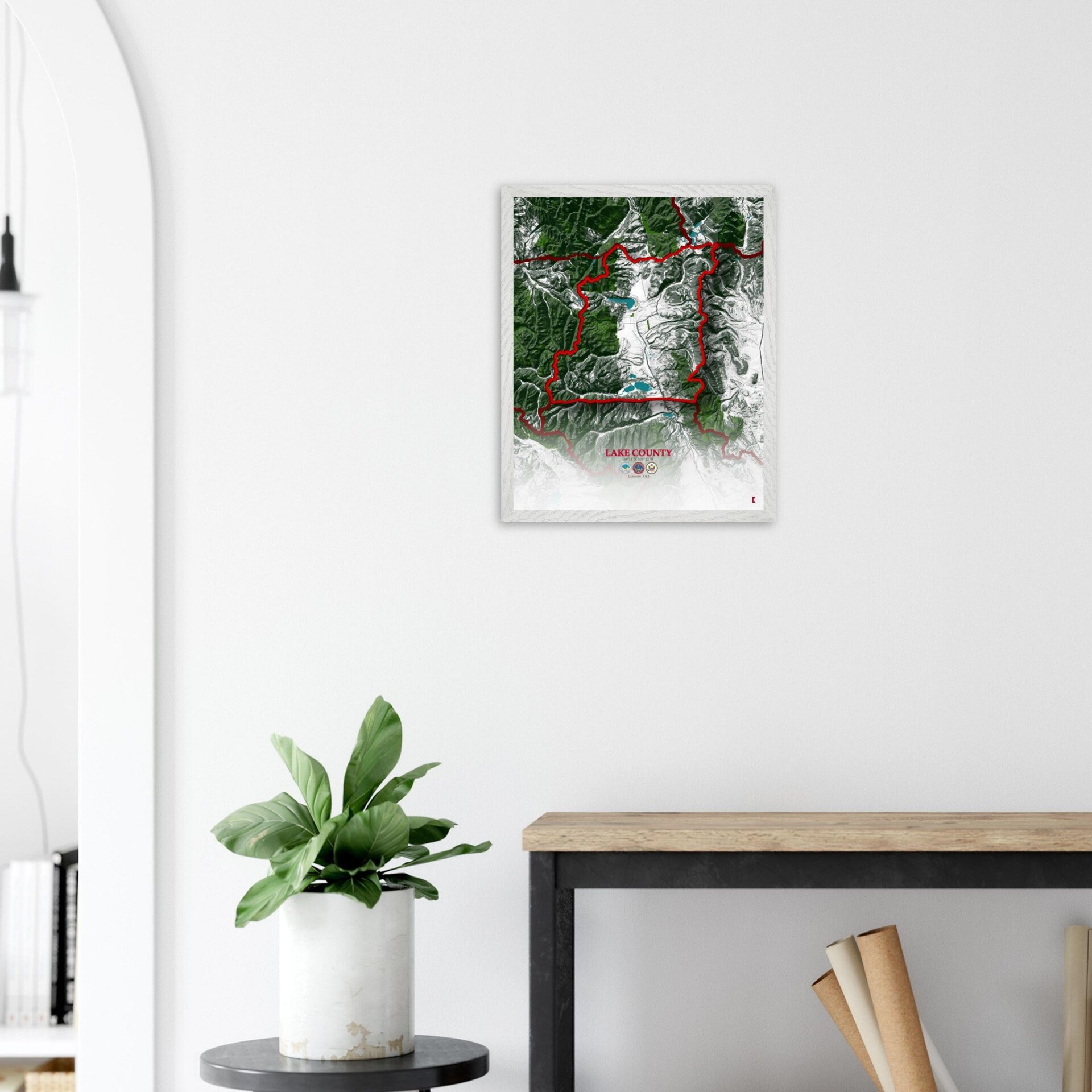
Lake County Map: A Breakdown of Colorado’s Hidden Gem
Lake County is a captivating region known for its rich history, dynamic economy, and breathtaking landscapes. Surrounded by neighboring counties like Summit to the north, Chaffee to the south, and Pitkin to the west, Lake County occupies a unique position in the central part of the state.
Its strategic location makes it a gateway to some of Colorado’s most picturesque areas, providing a blend of natural beauty and historical significance.
One of the highlights of Lake County is its abundance of historical sites that echo its vibrant past. The National Mining Hall of Fame and Museum, located in Leadville, pays homage to the county’s mining heritage, while the Healy House and Dexter Cabin offer a glimpse into the lives of the pioneers who once called this area home.
These sites, among others, serve as reminders of the county’s crucial role in Colorado’s development, making it a must-visit destination for history enthusiasts.
The economy of Lake County has evolved over the years, transitioning from a predominantly mining-based economy to one that is more diverse and robust.
Today, tourism plays a significant role, with visitors flocking to the area to experience its natural wonders and historical landmarks. Additionally, the county is seeing growth in sectors like outdoor recreation, small businesses, and local agriculture, contributing to its steady economic development.
With a population of approximately 8,000 residents, Lake County spans an area of 383 square miles, offering a balance between small-town charm and wide-open spaces.
The county seat, Leadville, is the highest incorporated city in the United States, sitting at an elevation of over 10,000 feet. This unique geographical feature adds to the county’s allure, attracting visitors who are eager to explore its rugged terrain and enjoy its cool, alpine climate.
Lake County’s combination of rich history, economic vitality, and scenic landscapes makes it a fascinating place to explore.
Whether you’re interested in its storied past, thriving present, or promising future, the detailed map of Lake County, CO, provides an excellent guide to understanding all that this remarkable region has to offer.
a fascinating place to explore
A Link To The Broader State Of Colorado

The roadmap of Lake County is defined by a network of key highways and avenues that interconnect its towns and cities. U.S. Highway 24 serves as the primary artery, running through Leadville and providing access to neighboring counties like Chaffee and Eagle.
Another significant route is State Highway 91, which heads north, leading travelers toward Summit County and the famous ski resorts of the area. These highways not only connect the county’s communities but also link them to the broader state of Colorado, making it easy for residents and visitors to navigate the region.
It´s Rugged Mountains, Deep Valleys, And High-Altitude Plains

Lake County’s topography is a striking feature, dominated by the towering peaks of the Sawatch Range, including the iconic Mount Elbert, the highest peak in Colorado. The county’s landscape is characterized by rugged mountains, deep valleys, and high-altitude plains.
The Arkansas River Valley cuts through the area, adding to the diversity of landforms found here. This varied topography offers numerous opportunities for outdoor activities, from hiking and mountain climbing to fishing and camping, making it a haven for nature lovers.
It´s Protected Green Areas

The natural beauty of Lake County is further enhanced by its protected green areas. The San Isabel National Forest, which covers a significant portion of the county, is home to a diverse range of vegetation, including subalpine forests and alpine tundra.
The climate here varies with elevation, offering a unique mix of flora and fauna. Wildlife such as elk, mule deer, and black bears can be found roaming the forests, while the county’s many trails offer breathtaking views of the surrounding mountains. The area experiences cool summers and snowy winters, making it a year-round destination for outdoor enthusiasts.
It´s Water Bodies Dotting Its Landscape

Lake County is aptly named, with several important water bodies dotting its landscape. Turquoise Lake, just west of Leadville, is one of the county’s most prominent features, offering opportunities for boating, fishing, and picnicking.
The Arkansas River flows through the county, playing a vital role in both the ecosystem and the local economy. These water bodies not only provide recreational activities but also contribute to the natural beauty and environmental health of the region.
Lake County Map – CO: A Peaceful Retreat From The Hustle And Bustle Of Daily Life.
| City | Population | Area (sq mi) |
| Leadville | 2,759 | 1.1 |
| Twin Lakes | 171 | 44.5 |
| Granite | 116 | 0.7 |
| Total for Lake County | 8,000 | 383 |
Lake County, CO, is a region that offers more than just stunning vistas and outdoor adventures. The map of this county, with its detailed depiction of roadways, topography, natural reserves, and water bodies, serves as a perfect piece for those looking to bring a touch of Colorado’s rugged beauty into their homes.
Whether displayed as a conversation starter or as a reminder of a memorable visit, the Lake County map is a decorative element that captures the essence of this extraordinary part of Colorado.


