Sequatchie County: A Guide to It’s Landscape and Heritage in Tennessee
Sequatchie County, nestled in the southeastern region of Tennessee, offers a fascinating glimpse into the charm and diversity of rural American life.
Bordering the counties of Hamilton to the south, Bledsoe to the east, and Grundy to the west, Sequatchie County enjoys a strategic position within the picturesque Sequatchie Valley. The county’s unique geography and historical significance make it a standout destination for those interested in exploring Tennessee’s rich heritage.
Historically, Sequatchie County is known for It’s pivotal role in the development of the region. Key historical sites include the historic town of Dunlap, the county seat, which has been a central hub for local culture and commerce.
The Sequatchie Valley, a significant geographical feature, has long been recognized for It’s role in the early settlement and agricultural development of the area.
Economically, Sequatchie County has a diverse profile. Agriculture remains a cornerstone of It’s economy, with the fertile lands of the Sequatchie Valley supporting various crops and livestock.
Additionally, local industries such as limestone quarrying and tourism contribute to the county’s economic vitality. The area’s scenic beauty and historical sites attract visitors and bolster the local economy.
With a population of approximately 14,000 residents, Sequatchie County covers an area of around 265 square miles.
This rural county is characterized by It’s close-knit community and a strong sense of local identity, making it a unique and endearing place within Tennessee.
The county’s natural features, including It’s diverse topography and abundant green spaces, offer a rich tapestry of exploration for residents and visitors alike.
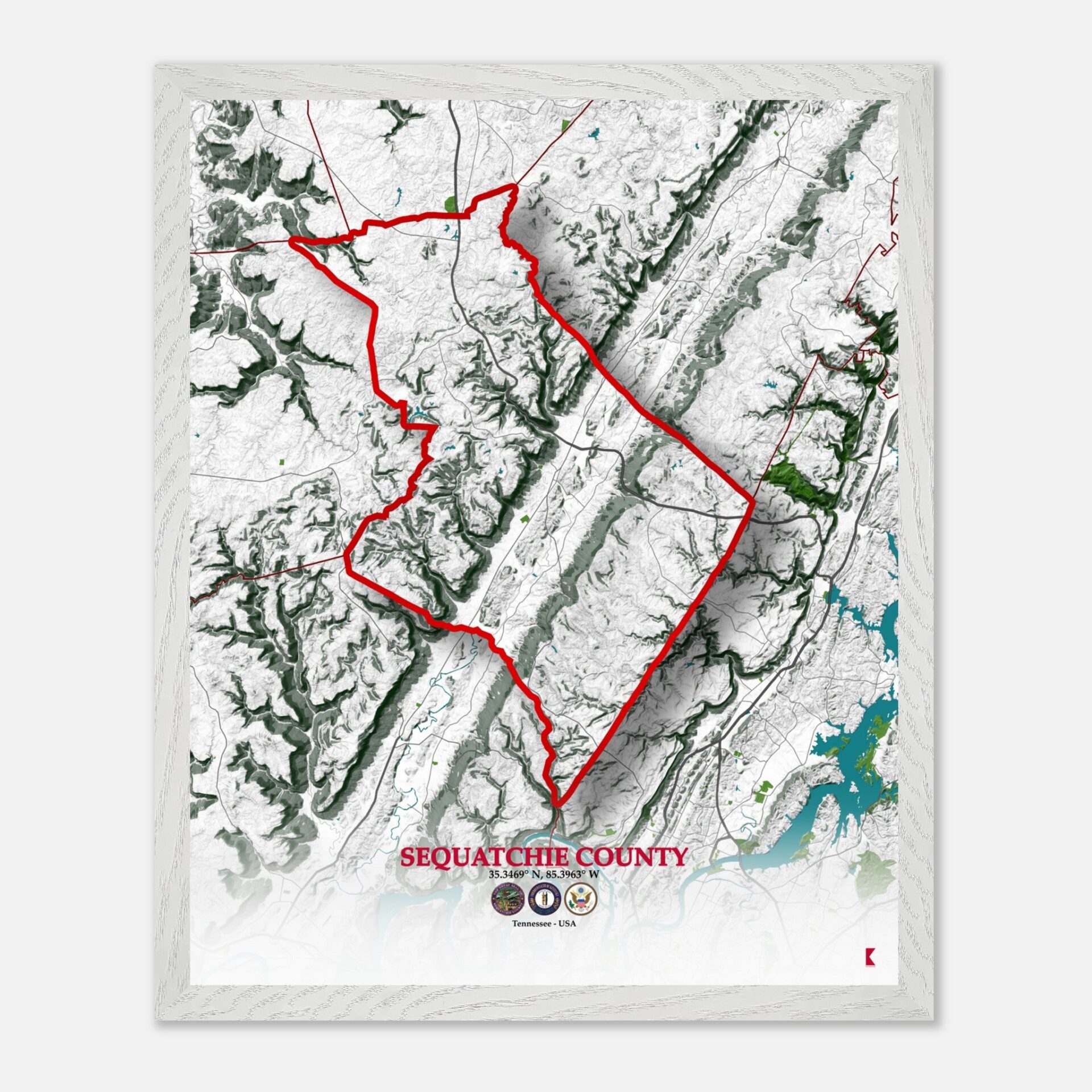
Sequatchie County’s map not only highlights It’s physical layout but also captures the essence of It’s cultural and historical landscape.
Sequatchie County’s map
Sequatchie County’s Road Network

Sequatchie County’s road network is well-developed, connecting It’s cities and towns with major highways and thoroughfares. U.S. Route 127, also known as the “Scenic Highway,” runs through the county, providing a crucial north-south route.
State Route 28 also serves as a significant east-west connector, linking Sequatchie County to neighboring regions. These highways facilitate access to key locations within the county and enhance connectivity to the broader state infrastructure.
It’s Distinctive Topography

Sequatchie County is renowned for It’s distinctive topography, dominated by the Sequatchie Valley. This valley is flanked by the Cumberland Plateau to the north and the Walden Ridge to the south, creating a varied landscape of mountains, valleys, and ridges.
The region’s elevation changes contribute to It’s diverse landforms, with steep slopes and deep ravines characteristic of the area. The topography plays a significant role in shaping the local climate and vegetation.
It’s Several Notable Natural Areas

Sequatchie County boasts several notable natural areas, including the Prentice Cooper State Forest to the south, which offers a range of outdoor activities and showcases the region’s rich flora and fauna. The forest is known for It’s diverse vegetation, including oak and hickory trees, and provides habitats for various wildlife species.
The county experiences a temperate climate, with annual temperatures averaging between 50°F and 70°F, supporting a lush and vibrant ecosystem.
What´s Flows Through Sequatchie County?

The county’s water resources are primarily centered around the Sequatchie River, which flows through the valley, providing vital water supplies for agricultural and recreational use.
The river’s presence significantly influences the local environment, supporting diverse aquatic life and contributing to the overall ecological balance of the region. Additionally, several small lakes and streams add to the county’s water features, enhancing It’s natural beauty.
Conclusion
| Municipality/Town/City | Population | Area (sq. miles) |
| Dunlap | 5,000 | 2.1 |
| Sequatchie | 1,800 | 1.3 |
| Whitwell | 4,500 | 2.5 |
| Other Towns | 2,700 | 2.6 |
| Sequatchie County | 14,000 | 265 |
Sequatchie County’s map is more than just a geographical representation; it is a reflection of the county’s rich tapestry of history, topography, and natural beauty.
As wall decor, this map serves as a tribute to the county’s unique character and offers a visually striking way to appreciate It’s landscape.


