Wyoming County Map: Your New York Guide to History, Economy, and Nature
Wyoming County offers a unique blend of scenic beauty, historical significance, and economic diversity.
Bordered by Genesee County to the north, Livingston County to the east, Allegany County to the south, and Erie County to the west, Wyoming County is a hidden gem in the rural heart of New York. Despite its small size, this county plays a significant role in the state’s agricultural and economic landscape.
Wyoming County is rich in history, with several historical sites that draw visitors interested in the region’s past. The Arcade and Attica Railroad, a heritage railway offering scenic train rides, and the Warsaw Historical
Society, showcasing local history, are just a few of the historical attractions that highlight the county’s storied past. These sites not only preserve the history of Wyoming County but also contribute to its cultural and tourism sectors.
The economy of Wyoming County is primarily driven by agriculture, with dairy farming being the dominant industry. The county is one of the leading milk producers in the state, with farms such as Noblehurst Farms and Lamb Farms being key contributors.
In addition to agriculture, Wyoming County has a growing renewable energy sector, with wind farms like the Sheldon Wind Farm becoming increasingly significant to the local economy.
With a population of approximately 40,000 residents and covering an area of 596 square miles, Wyoming County is a community where rural charm meets economic vitality.
The population is spread across small towns and villages, with Warsaw, the county seat, being the most populous area. Despite its rural nature, the county is well-connected and offers a high quality of life to its residents.
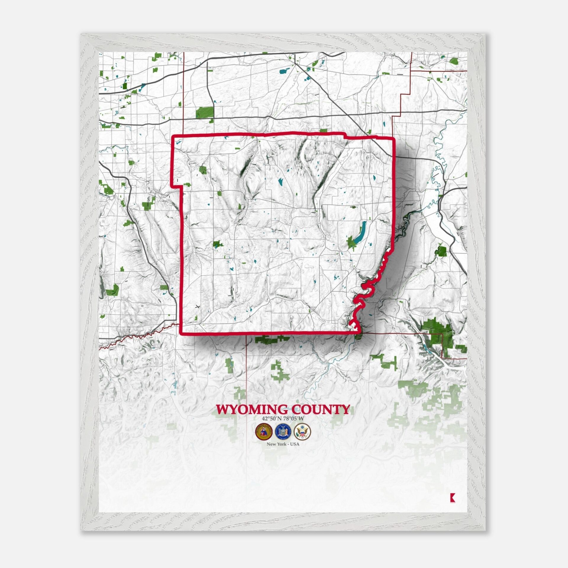
the key characteristics of Wyoming County as depicted on a detailed map
Crisscrossed By Several Key Highways And Roads

Wyoming County is crisscrossed by several key highways and roads that connect its towns and villages, making it easy to navigate through this rural region. New York State Route 19 runs north-south through the county, passing through Warsaw and connecting to other major roads.
New York State Route 20A is another significant east-west route, linking Warsaw to other towns like Perry and Geneseo in Livingston County. Additionally, New York State Route 63 serves as a vital north-south corridor on the eastern side of the county, connecting Pavilion to Dansville. These highways not only facilitate local travel but also connect Wyoming County to the broader region, making it accessible for commerce and tourism.
It´s Rolling Hills, Valleys, And Fertile Farmlands

The topography of Wyoming County is characterized by rolling hills, valleys, and fertile farmlands that are typical of the western New York landscape. The Allegheny Plateau extends into the county, providing a varied terrain that includes both upland areas and low-lying valleys.
Letchworth State Park, often referred to as the “Grand Canyon of the East,” lies on the eastern border of the county, featuring deep gorges, waterfalls, and a scenic landscape that is a major attraction for both locals and visitors. The county’s elevation ranges from about 600 feet above sea level in the north to over 1,300 feet in the southern hills, offering a mix of gentle slopes and steeper inclines that define its agricultural and natural landscapes.
A Haven For Outdoor Enthusiasts

Wyoming County is home to several important natural reserves and green spaces that contribute to its reputation as a haven for outdoor enthusiasts. Letchworth State Park, one of the crown jewels of New York’s park system, is partly located within Wyoming County and offers a wide array of recreational opportunities, from hiking to birdwatching.
The park is known for its lush forests, diverse wildlife, and the Genesee River, which cuts through the park to create spectacular waterfalls. Additionally, the Silver Lake State Park in the northern part of the county provides a picturesque setting for fishing, boating, and camping, while the Attica Reservoir is another significant natural area that plays a crucial role in the local water supply and offers serene natural beauty.

Water Means On Economy
Water bodies play an essential role in the landscape and economy of Wyoming County. The Genesee River is the most prominent watercourse, flowing through Letchworth State Park and providing both natural beauty and a resource for local communities.
Silver Lake, located near the village of Perry, is another significant water body that serves as a popular destination for fishing, boating, and other recreational activities. In addition to these, the Oatka Creek meanders through the county, offering scenic views and opportunities for fishing and hiking along its banks. These water bodies are vital not only for recreation but also for supporting the agricultural activities that dominate the county’s economy.
Wyoming County Map – NY: A Detailed Snapshot of Community and Nature
| Cities | Population | Area (sq mi) |
| Warsaw | 5,064 | 5.4 |
| Arcade | 4,205 | 3.6 |
| Perry | 3,702 | 2.8 |
| Attica | 2,547 | 2.4 |
| Castile | 2,012 | 3.1 |
| Silver Springs | 846 | 1.2 |
| Wyoming County Total | 40,000 | 596 |
Wyoming County, NY, with its rich history, varied topography, and significant natural resources, offers a fascinating glimpse into rural life in New York State.
The map of Wyoming County is not just a navigational tool but a window into the region’s heritage, economy, and natural beauty. Whether displayed as a decorative piece or used for educational purposes, this detailed map serves as a reminder of the charm and significance of Wyoming County, making it a meaningful addition to any collection.


